
Local News
See updates on the 3 largest Southern California wildfires – NBC Los Angeles
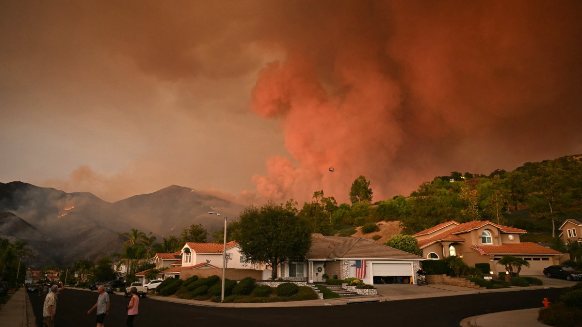
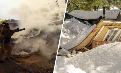
Firefighters are increasing containment of three major wildfires after a drastic change in weather conditions this week in Southern California.
The region’s three largest fires — the Bridge, Airport and Line fires — all started in early September during a stretch of extremely hot days.
Below, see updates on the fires, including size, containment and evacuation information.
Bridge Fire
The Bridge Fire was 35-percent contained Wednesday with evacuation warnings lifted and evacuation orders downgraded to warnings in both Wrightwood and Mt. Baldy.
Water-dropping aircraft were putting out hot spots around the southeast corner of the fire zone. Secondary containment lines were being established on the south side of the fire. The northwest flank of the fire still has scattered flames. To the east, firefighters were constructing a line south from Wright Mountain to prevent the fire from reaching Lytle Creek.
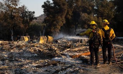
The fire has destroyed 73 structures and damaged 16 others.
In Los Angeles County, an evacuation order remained in effect for the East Fork communities, including Camp Williams Resort and the nearby River Community.
In San Bernardino County, evacuation orders remained in effect for the area north of Icehouse Canyon and along Big Pines Canyon road to the community of Big Pines.
An evacuation order that was in effect for the entire Wrightwood community was changed to an evacuation warning Tuesday.
An evacuation warning also remained in place for Shin Road north to Icehouse Canyon.
The fire began Sept. 8 near East Fork and Glendora Mountain roads.
Line Fire
The Line Fire, which was caused by arson, has burned more than 39,100 acres in San Bernardino County. Containment Wednesday was at 50 percent.
Evacuation orders remain in effect due to a closure order for National Forest lands, trails, and roads, including the San Gorgonio Wilderness. Evacuation warnings are in effect for thearea of Big Bear Valley east of the dam and west of McAllister Road, including Fawnskin; all of Green Valley Lake, Running Springs, Arrowbear Lake, Angelus Oaks, Seven Oaks and all campgrounds and cabins in the area.
Highway 330 is closed northbound from Highland Avenue to Live Oak.
Minimal fire growth was reported overnight due largely to the drop in temperatures. Partly cloudy conditions are expected Wednesday, which should help firefighters increase containment and mop up hot spots.
There have been multiple drone incursions over the Line Fire area, according to fire officials.
“This impedes our firefighting operations and can have deadly consequences,” Cal Fire said. ” Please be respectful of those fighting the fire and the community members who are impacted by fire. Never fly drones near wildfire. If you fly, we can’t.”
A Norco man who was accused of starting the fire pleaded not guilty in San Bernardino County.
The Line Fire destroyed one structure and damaged four others.
Airport Fire
The 23,500-acre Airport Fire in Orange and Riverside counties was 31-percent contained. Area of increased containment included Lake Elsinore, Decker Canyon Road and Lakeland Village.
Cooler temperatures have helped firefighters, who continued water drops on Santiago Peak. Downed powerlines were posing a hazard, and firefighters are working with utility companies on Ortega Highway to find hot spots and perform repairs.
In Orange County, people in Caspers Regional Park, San Juan Springs, Blue Jay campground were ordered to evacuate, while a larger number of neighborhoods were under evacuation orders and evacuation warnings in Riverside County.
Evacuation warnings were in place in Orange County for portions of Ortega Highway, Robinson Ranch HOA, Trabuco Highlands HOA, Trabuco Highland
Apartment Complex, the East Side of Coto de Caza, Silverado Canyon, Modjeska Canyon, Rose Canyon Road, Trabuco Creek Road, Trabuco Canyon Road, Trabuco Oaks Drive, Joplin Loop, Cook’s Corner, Dove Canyon, El Cariso.
The fire started Sept. 9 in Trabuco Canyon and spread from Orange County into Riverside County.


Local News
How to add California driver’s license to iPhone, Apple Watch – NBC Los Angeles
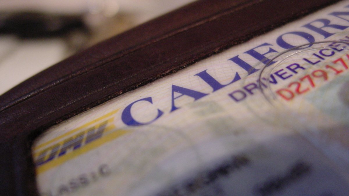
California driver’s license holders can now add their state ID to Apple Wallet on their IPhone and Apple Watch, Gov. Gavin Newsom announced Thursday.
The digital IDs will be accepted at Transportation Security Administration (TSA) check points, including Los Angeles International Airport and San Francisco Airport, as well as select businesses.
“With this new integration, we’re working to better serve the people of California in the 21st Century,” Newsom said in a statement.
Here’s how to add your ID to Apple Wallet
- Go to Apple Wallet
- Click the + button on the top right-hand corner
- Under the “Add to Wallet” section, tap “Driver’s License or State ID” to select “California mDL Pilot.
- Scan the front and back sides of your California ID
- Scan your face
- Take a picture
- Wait for verification from the California DMV.
But there’s a catch
The mobile driver’s license (mDL) pilot program is currently only limited to 1.5 million participants.
If your license is expired or suspended, your mDL will be rejected.
Other factors that could impact your mDL applications are:
- Wearing headwear
- Not using plain background
- Lack of consistent lighting
- Other faces in the frame
- Wearing sunglasses
More tips can be found here.
Last month, the state announced the DMV addition of Google Wallet as an option to hold driver’s licenses and identification cards.
Local News
Find Riverside County Airport Fire recovery assistance – NBC Los Angeles
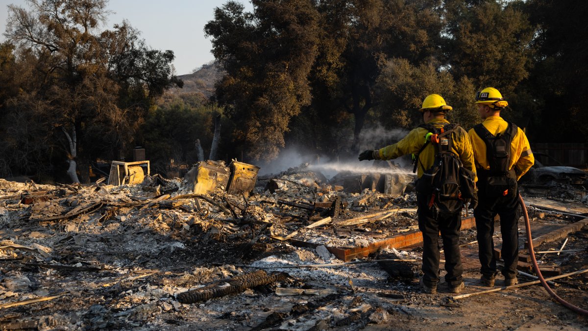
Residents impacted by the Airport Fire in Riverside County can visit a local assistance center in Lake Elsinore.
Residents seeking assistance with food, health care support and more are welcomed to visit the one-stop resource center located at the Lake Community Center. The center will be open from noon to 9 p.m. Thursday and Friday, and 8 a.m. to 5 p.m. Saturday.
The Riverside County Department of Public Social Services, Public Health, Housing & Workforce Solutions and other local agencies will be joined by representatives from the California Office of Emergency Services and several nonprofit organizations to provide information on how to get financial, medical and related aid.
Residents seeking help also can click here.
On Tuesday, the Riverside County Board of Supervisors approved an emergency declaration, enabling the county to seek state and federal allocations for infrastructure repairs or improvements and general recovery of expenses stemming from the blaze.
As of Thursday, the Airport Fire was 41% contained at more than 23,500 acres in Orange and Riverside counties.
For information about Orange County recovery resources, click here.
Local News
Find Orange County Airport Fire recovery resources – NBC Los Angeles

Orange County launched a website and plans to open an assistance center to provide residents with information about recovering from the Airport Fire.
Residents affected by the fire, which also burned in Riverside County, can click here to find information about wildfire assistance.
The county also will open a wildfire recovery assistance center at Saddleback College in Mission Viejo. The center will be open from 3 to 9 p.m. Thursday; 3 to 9 p.m. Friday; and 9 a.m. to 2 p.m. Saturday at 28000 Marguerite Parkway in the second-floor lounge.
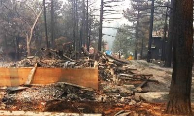
The fire, which started more than a week ago, has burned 23,519 acres with containment at 39 percent. The fire destroyed 160 structures and damaged 34 others.
Below-normal temperatures are helping firefighters make progress with helicopter water drops. Crews are working to increse the perimeter with warmer weather in the forecast.
Most evacuation orders and warnings were lifted in Orange County, but many are still in effect in Riverside County. Residents can visit this page to determine if their homes are impacted by evacuation orders or warnings.
The fire was one of three major fires that started during a week of extremely warm temperatures in Southern California.
Information about Los Angeles and San Bernardino county recovery resources can be found here.
-

 News8 months ago
6 Ways To Attract a Rich Girl of Your Dream
-

 Finance7 months ago
Which credit card is best for small businesses?
-

 Finance7 months ago
Best Business Credit Cards With 0% APR – February 2024
-

 Finance7 months ago
How To Apply For A Chase Business Credit Card
-

 Finance8 months ago
Lowe’s Credit Card: New Discounts on Lowe’s Purchases
-

 Finance7 months ago
Limited Time: Sign up for Chase Freedom Unlimited for a Year of Unlimited Cash Back!
-

 Entertainment9 months ago
Netflix Schedule January 2024
-

 Tech8 months ago
Apple Vision Pro: $3,499 headset finally has a release date